

- J. Lukačevič, K. Kertýsová, R. Heise
- 18 August 2022
- NATO
Climate change presents major challenges that NATO faces today, and will have to confront tomorrow. Space technology is playing an increasingly important role in helping to monitor rapid environmental change and identify related hazards.
NATO already recognises space capabilities as critical in the area of environmental monitoring, meteorological forecasting, and the planning and execution of NATO missions and operations. Yet, the benefits of space technology for improved operational effectiveness remain underutilised.
At the Madrid Summit in June 2022, NATO released its first Climate Change and Security Impact Assessment (CCSIA), an element of an ambitious Action Plan on Climate Change and Security, which was adopted at the Brussels Summit in June 2021. The CCSIA intends to increase Allied awareness concerning the impact of climate change on security. In addition to maritime, land and air domains, the Impact Assessment underlines the threat climate-related hazards present to the operational domain of space. In addition, the newly approved NATO Strategic Concept recognises that unfettered access to, and the secure use of space is key to effective deterrence and defense, and suggests boosting the resilience of Allied space capabilities.
Because space and climate-related issues are intrinsically intertwined, both climate and space resilience are fundamental to NATO’s deterrence and defense in the 21st century. This article will explore two ways in which climate change and space technologies intersect.
Improved understanding of a changing climate
Satellites are providing NATO Allies with invaluable data about the Earth’s climate and weather patterns, and a better understanding of a changing climate overall. Closely monitoring various natural hazards, such as landslides, floods and large forest fires, aids in disaster relief operations by making it possible to identify the events early on, recognise their extent, and reduce overall damage by responding swiftly and effectively. Satellite data is also being used to develop more accurate climate models, which are essential for predicting future climate risks and their impacts.

Space-based observing systems are also helping to monitor greenhouse gas (GHG) emissions and overall changes in the composition of our atmosphere. These systems are key to improving climate change predictions and developing effective mitigation and adaptation strategies. Since 2009, the Greenhouse Gas Observing Satellite (GOSAT), also known as “Ibuki”, has been providing detailed data about atmospheric concentrations of carbon dioxide and methane, improving scientific understanding of the causes of global warming.
Space technologies can also play a key role in monitoring and verifying compliance with international climate agreements. In support of the non-profit organisation Carbon Mapper and its consortium of partners, NASA participates in a pioneering program that will help quantify and track point-source emissions, identify “super emitters”, all while making collected data on emissions publicly accessible. The first Carbon Mapper satellite is targeted for launch in 2023. As part of the European Union’s Copernicus programme, in 2021-2023 the CoCO2 project will deliver prototype systems for a new European anthropogenic CO2 emissions monitoring and verification support capacity. Now that NATO is set to reduce its military GHG emissions, these capabilities can enable Allied militaries to provide more rapid and targeted disaster response and aid in emissions estimates.
Enhanced operational effectiveness
The focus of civilian space capabilities has traditionally revolved around earth observation, environmental monitoring and weather observation. Advances in satellite technology are also reducing limits on global communications, providing Internet access to remote locations. But the potential of satellites and other space technologies goes beyond just climate monitoring and improved communications.
Today, technologies that were initially conceived and used to track weather events are helping Allied militaries to improve their combat capabilities, operational effectiveness, and battlefield situation awareness. This is particularly evident in the case of the ongoing war in Ukraine, where Ukrainian forces that track Russian troop movements are being aided by radar data and satellite imagery.
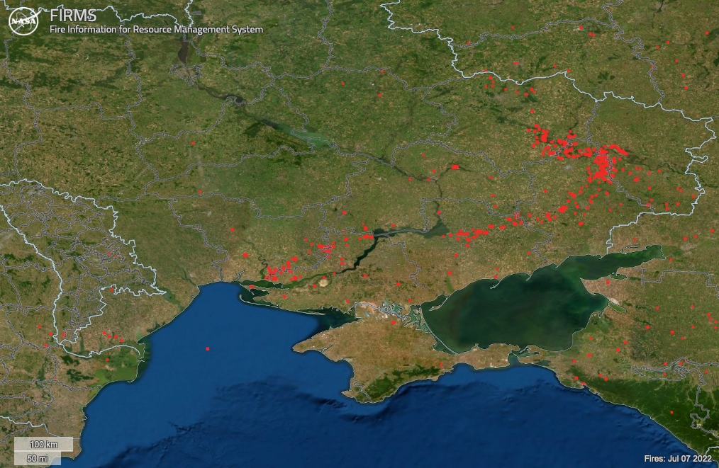
For example, data from the European satellite, Sentinel – previously used to survey vegetation growth – has been helping to assess damage to buildings and, as such, Russian gains and advances across Ukraine. Prior to the invasion, the same tools helped track deployments of certain military radars, which provided clues about the movement of troops and equipment in western Russia. In addition to Sentinel-2, NASA Fire Information for Resource Management System (FIRMS), developed for near-real time forest fire monitoring, has helped detect and monitor heavy fighting and fuel storage explosions, as well as wildfires in the contaminated areas around Chernobyl.
Looking ahead, space-based observing systems will enable members of the Alliance to plan their operations in more effective ways. For example, they will be able to better optimise their routes and logistics, with significant savings in terms of costs and fuel use. Reducing NATO’s reliance on fossil fuels, which make armed forces vulnerable to attack, is key.
Another example is the multi-year Cube4EnvSec project, launched as part of the NATO Science for Peace and Security (SPS) programme, which aims to integrate big earth observation data (i.e. Landsat- and Sentinel satellite data), artificial intelligence and a visualisation for a Military Recognized Environmental Picture (REP).
5G technology, in combination with telecommunication satellites and advanced encryption methods, will have significant strategic and battlefield implications for military operations, too. With 5G and new datalink technologies, Allied militaries will be able to communicate and undertake remote sensing in real-time, as well as to integrate various sensors over and on the battlefield. This will help militaries and the civilian sector alike to further optimise their logistics and situational awareness.
Space capabilities are not immune to climate change
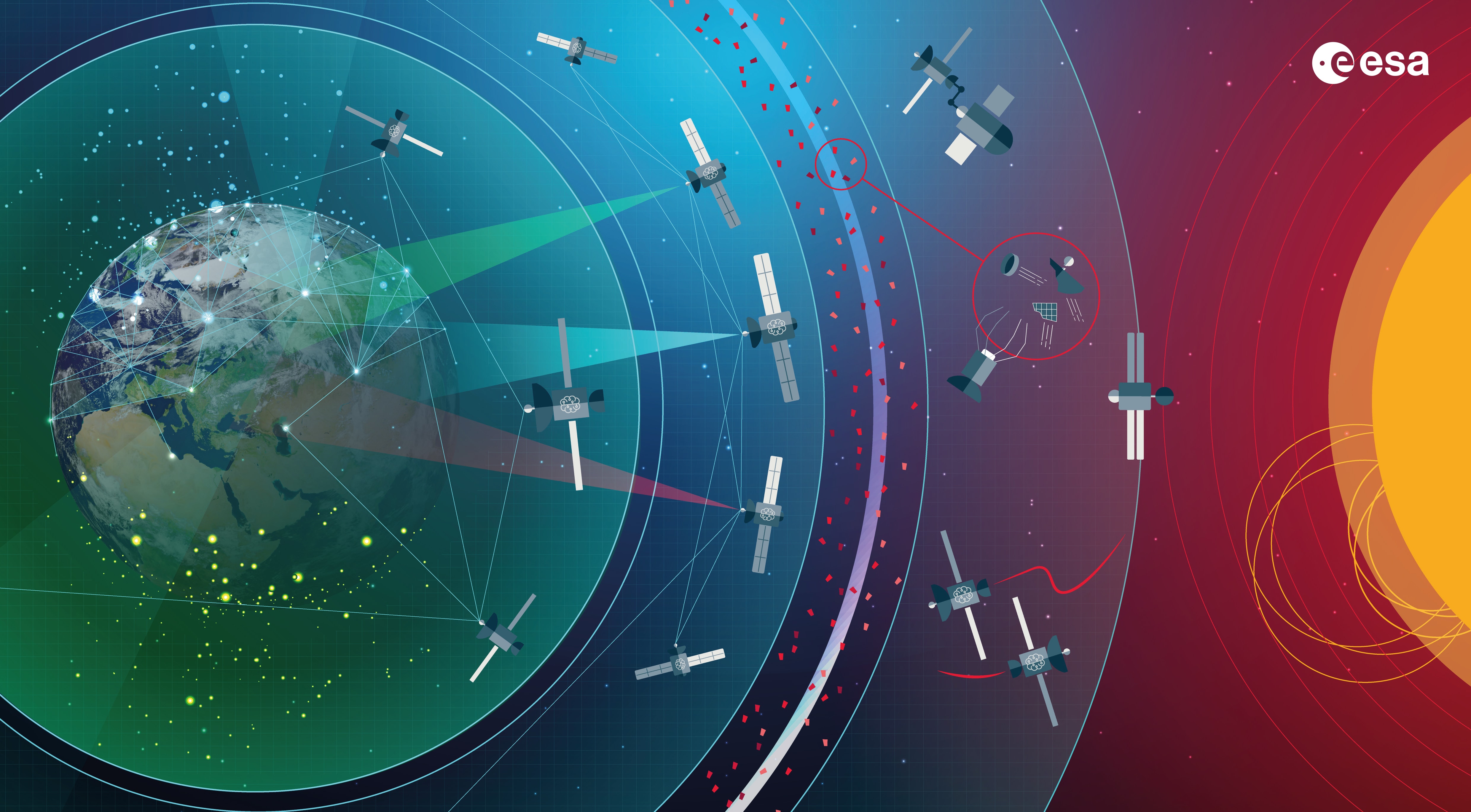
Allied military space assets are critical to NATO’s security and resilience, providing NATO members with essential intelligence and communications capabilities. Climate change is increasingly impacting the ability to operate in space, limiting the potential value that space capabilities can add for Allied militaries, and potentially jeopardising NATO’s operational effectiveness in several ways.
First, climate change affects ground-based infrastructure, such as launch pads, communication towers and other facilities that are critical to space operations. This is of greater concern to Western space capabilities than it is to Russian and Chinese space capabilities. The primary launch sites of NATO members – Vandenberg Space Force Base in California, Cape Canaveral Space Force Station in Florida and French Guiana Space Station – are all situated along coastlines and increasingly find themselves at major risk from sea-level rise, coastal erosion and flooding. According to NASA estimates, for example, sea levels at Kennedy Space Center are expected to rise by 5 to 8 inches by 2050.
Second, there are 14 weather criteria that have to be met to ensure that a rocket is safe throughout its entire launch process. Unfavourable weather conditions, such as thunderstorms and lightning, heavy precipitation, thick cloud coverage, freezing air temperatures or strong windshear and turbulence could influence launch trajectories for satellites and missiles alike, endanger their safety, and cause a launch to be postponed. Even after a successful launch, rain, wind or rough sea can make it challenging for reusable rockets – which almost every major company is developing or using – to land, which affects their future utilisation. Changes in weather patterns, which are likely to become more frequent and intense due to climate change, will challenge the viability of space operations in certain regions in the future.
In contrast, the majority of Chinese launch sites, as well as those operated by Russia, namely the Vostochny Kosmodrome in the south-east part of Russia and the Baikonur Cosmodrome in Kazakhstan, are located inland, thus benefiting from more stable weather conditions, and are less vulnerable to climate change.
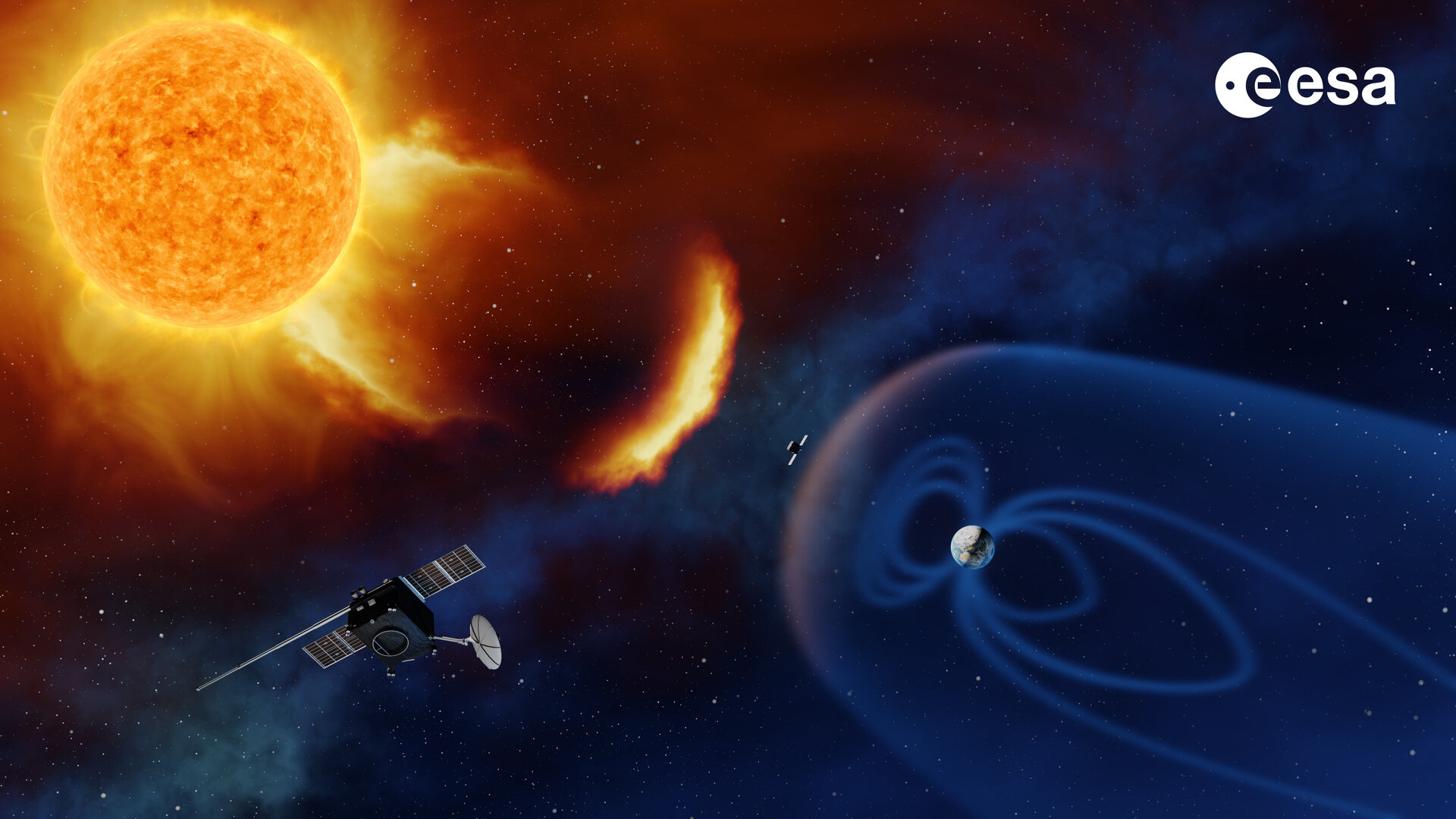
Third, phenomena related to space weather significantly endanger Allied critical infrastructure, both on Earth and in space. Earlier this year, as many as 40 SpaceX Starlink internet satellites were lost due to a geomagnetic storm only a day after their launch. While disturbances caused by solar events are not a direct result of climate change, they nevertheless increase the vulnerability of Allied space technologies and present challenges for military effectiveness. Moderate to severe space weather events can disrupt radio communications, affect power grids and global navigation satellite systems (GNSS), or, in the event of a large-scale geomagnetic storm, cause the complete outage of satellites. For example, a communications outage during military operation “Anaconda” in Afghanistan in 2002 is believed to have been related to an important space weather phenomenon called plasma bubbles.
Due to global warming, the mesosphere (the third layer of the atmosphere, directly above the stratosphere) is cooling and contracting. When it contracts, the upper layers sink with it; thus, the density of upper layers of the atmosphere decreases. This, in turn, reduces satellite drag. As a consequence, the insufficient slowing of spacecraft leaves more space debris in a low-Earth orbit that would otherwise be pulled down and incinerated. This presents a challenge for satellite operators, regulators, and other companies that seek to build mega constellations of satellites. It particularly affects planning times and deployment durations of new small and miniature satellites (cubesats). Hence, more efforts are needed to actively remove satellites and space debris from orbit.
Recommendations in preparing for the unknown
Resilience is fundamental to NATO’s ability to deter and defend. As the effects of climate change on Allied security become more apparent, NATO needs to use all available tools to address them. Space technologies are playing an important role in these efforts, and they are only going to become more important in the years to come. In addition to preparing to operate in changing climate conditions, there is a need for NATO to address the climate-related implications on its space capabilities to ensure secure and continuous access to space services, products and capabilities.
Additional investments in space technologies are needed, and should come hand-in-hand with sufficient staffing capacity at NATO to enact robust programming. One source of funding will be the newly launched €1 billion Innovation Fund, which is set to focus on space (among other dual-use emerging technologies). Through NATO’s Defense Innovation Accelerator for the North Atlantic (DIANA), which is to be launched in 2023, NATO – particularly the Science and Technology Organization (STO) and the NATO Space Center – can deepen its work with innovators across the Alliance on the non-traditional use of space technology for military applications. Of particular relevance is the improved utilisation of the so-called space downstream sector – applications using space data and technology to the benefit of business and society (e.g. space navigation, space telecommunication, and space imagery). The continuous adjustment and adaptation of NATO’s Space Policy and Space Situational Awareness is equally important.
Finally, members of the Alliance need to better prepare for and protect their space capabilities from climate-related hazards. Investing in more resilient and mobile ground infrastructure, or diversifying Allied launch capabilities, are ways to address climate-related risks. Another is supporting research on new technologies to protect satellites from debris, and developing new strategies for operating in a more congested and contested space environment. Engineering solutions, like building dunes along coasts, provide good short-term strategies too. Of equal relevance is improving weather forecasting and research focused on space weather.
Addressing climate-related implications on its space capabilities is a necessity, not a choice, for NATO to maintain its technological edge and operational advantage.
