Modern communications rely on submarine fibre-optic cables which carry more than 95 percent of all voice and data transmissions. The Middle East and North Africa region is central to this network
The Middle East and North Africa region has been a hub for shipping and commerce routes between Europe, Asia and Africa for centuries. Now it is data and communications that flows through its busy waters. Each of the lines on this map is not a trade route but a fibre-optic cable, carrying billions of pieces of data each second. Each dot is not a port but a landing site, where the cables connect to a country and link it and its people to the wider global network (TeleGeography/Google Maps).
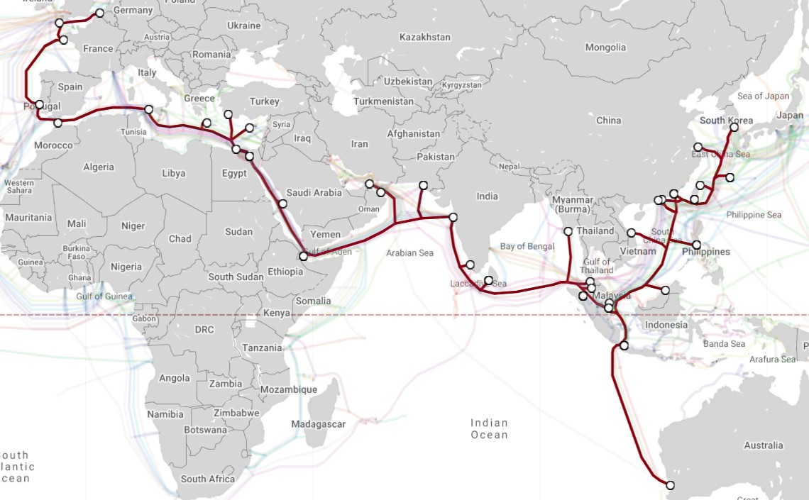
SeaMe We-3, the world’s longest cable at 39,000km, links north-western Europe with Australia and South Korea via the Middle East and South Asia. It became fully operational in September 1999 and is owned by an international alliance of more than 50 telecom companies (TeleGeography/Google Maps).

France and Algeria are linked by several cables, most notably the 1,300km Med Cable Network, which is operated by Orascom Telecom. Opened in October 2005, it runs for 1,300km and links landing points at Marseille with those on the coast of Algiers , Oran and Annaba (TeleGeography/Google Maps).

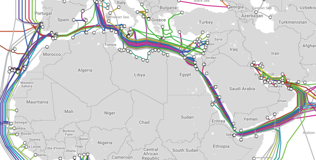
The coast of Libya is dotted with 14 landing points. The main cable, the Libyan Fiber Optic Network, opened in 1999 and runs for 1,640 km from Zuwara in the east through to Derna in the east. The much shorter Tobrok-Emasaed Cable System links El-Quawef, close to the Egyptian border, with the rest of the network. Libya’s main link to the wider global infrastructure is through Tripoli, part of the 15,000-km Europe India Gateway network (TeleGeography/Google Maps).

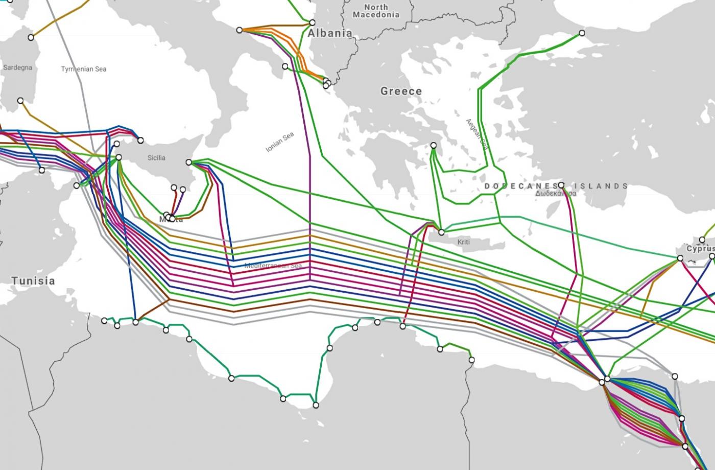
Not all cable systems run end-to-end: in the eastern Mediterranean, the 7,000-km circuitous MedNautilus Submarine System links Israel, Italy and Cyprus as well as regional rivals Greece and Turkey. It opened in 2001 and is operated by Telecom Italia Sparkle (TeleGeography/Google Maps).

BERYTAR, at only 135km long, is a collaboration between the Syrian Telecommunications Establishment and the Lebanese Ministry of Telecommunications. Opened in 1997, it runs along the coast of Syria and Lebanon, from Tartous in the north to Saida in the south. Tripoli is also part of the 12,000 km trans-continental IMEWE network, while Tartous links up to Alexandria in Egypt, one of the world’s major cable hubs (TeleGeography/Google Maps).

The breakaway Turkish Republic of Northern Cyprus, which is recognised only by Ankara, is connected to Turkey through two cables: Turcyos-1 runs for 110km between landing points at Girne and Mersin; and Turcyos-2 extends for 215km between Iskele and Samandag. The Republic of Cyprus, a European Union member state, has two landing points which directly link to 11 cables, from the local 800km POSEIDON, which runs along Cyprus’s southern coast, to the 39,000km-long SeaMeWe-3, which runs from western Europe to the Far East and Australia.

Up to 30 percent of the global population’s internet connectivity goes through Egypt due to its geographical position as a gateway between Europe and North America on one side and Asia on the other. It has 10 cable landing stations on its Mediterranean and Red Sea coastlines, with 15 cables crossing its land (TeleGeography/Google Maps).
 The cables from Egypt then run south down the Red Sea, with landing points in Sudan, Saudi Arabia and Yemen among others (note how Eritrea has no landing points). The cables then bottleneck between Djibouti and Yemen, which each have landing points before heading due east towards Asia and, after the Horn of Africa, southern Africa (TeleGeography/Google Maps).

Not every territory in the Middle East and North Africa has landing points to enable fast internet access. The Western Sahara (above left) is bypassed by half-a-dozen cables off its coastline, while the nearby Canary Islands, part of Spain, have 18 landing points. Gaza (right) is also without landing points, the closest of which are further up the coast in the Israeli cities of Tel Aviv and Haifa (TeleGeography/Google Maps).

A network of two systems – the GBICS and the MENA – run for 5,270km, from Kuwait City in the west with Mumbai in the east. Countries which are part of the network include regional rivals Iran, Saudi Arabia, Qatar and the UAE. The network also links up the many islands in the region – the 380km Kuwait-Iran network has landing points serving the Iranian oil terminals of Khark Island and Soroosh Platform (TeleGeography/Google Maps).
For more information, please see TeleGeography’s Submarine Cable Map.
https://www.middleeasteye.net/news/underwater-cables-internet-middle-east